Geological hazards encompass natural events such as earthquakes, volcanic eruptions, landslides, and tsunamis that pose significant risks to life and infrastructure. Understanding their causes and impacts is essential for disaster preparedness and risk mitigation. This infographic visually presents key information about these hazards to enhance public awareness and safety.
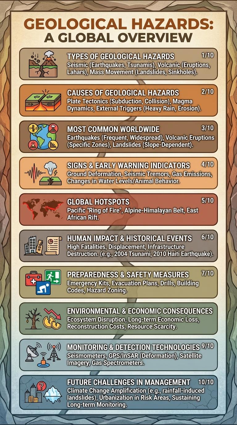
Types of Geological Hazards
Geological hazards refer to natural events caused by Earth's dynamic processes that can pose significant risks to life and property. Understanding the different types of geological hazards aids in disaster preparedness and risk mitigation.
- Earthquakes - Sudden shaking of the ground caused by the movement of tectonic plates beneath the Earth's surface.
- Landslides - Downward movement of rock, soil, and debris on slopes triggered by rainfall, earthquakes, or human activities.
- Volcanic Eruptions - The expulsion of magma, ash, and gases from a volcano, often resulting in lava flows and ashfall.
- Tsunamis - Large sea waves generated by underwater earthquakes or volcanic eruptions that can flood coastal areas.
- Sinkholes - The collapse of the ground surface into underground voids caused by natural or human-induced soil erosion.
Causes of Geological Hazards
Geological hazards are primarily caused by natural processes such as tectonic plate movements, volcanic activity, and erosion. These dynamic earth processes trigger events like earthquakes, landslides, and volcanic eruptions. Human activities, including mining and deforestation, can also exacerbate the frequency and severity of geological hazards.
Most Common Geological Hazards Worldwide
Geological hazards pose significant risks to human life and infrastructure across the globe. Understanding the most common types can help improve preparedness and response strategies.
- Earthquakes - Sudden ground shaking caused by tectonic plate movements leading to structural damage and potential loss of life.
- Volcanic Eruptions - Explosive release of magma, ash, and gases from volcanoes that can destroy landscapes and impact air quality.
- Landslides - Downslope movement of soil and rock triggered by rainfall, earthquakes, or volcanic activity, causing damage to property and blocking roads.
Signs and Early Warning Indicators
Geological hazards include earthquakes, landslides, volcanic eruptions, and tsunamis. Early detection of these events can save lives and reduce property damage.
Signs of impending geological hazards often involve unusual environmental changes such as ground shaking, cracks in the earth, and sudden changes in water levels. For earthquakes, foreshocks and increased animal activity may signal an upcoming event. Volcanic hazards can be anticipated by monitoring gas emissions and ground deformation around the volcano.
Global Hotspots for Geological Hazards
| Geological Hazard Hotspot | Primary Hazards |
|---|---|
| Ring of Fire, Pacific Ocean | Volcanic eruptions, earthquakes, tsunamis |
| Himalayan Region | Earthquakes, landslides |
| East African Rift Valley | Volcanic activity, earthquakes |
| Andean Mountain Range, South America | Earthquakes, volcanic eruptions, landslides |
| Mediterranean-Asian Seismic Zone | Earthquakes, landslides |
Human Impact and Historical Events
Geological hazards such as earthquakes, tsunamis, and volcanic eruptions have significant impacts on human populations, often leading to loss of life, displacement, and economic disruption. Urban areas located near fault lines or volcanic zones are particularly vulnerable to these natural disasters.
Historical events like the 2011 Tohoku earthquake and tsunami in Japan caused over 15,000 deaths and triggered a devastating nuclear crisis. The 1980 eruption of Mount St. Helens resulted in massive environmental changes and highlighted the importance of monitoring volcanic activity for hazard mitigation.
Preparedness and Safety Measures
How can individuals prepare for geological hazards effectively?
Understanding the types of geological hazards in your area is crucial for preparedness. Having an emergency kit with essential supplies ensures safety during and after an event.
What safety measures should be taken during an earthquake?
Drop, cover, and hold on to protect yourself from falling debris. Stay indoors away from windows and heavy objects until shaking stops.
How can communities reduce risks from landslides?
Implementing proper drainage systems helps prevent soil erosion and landslides. Early warning systems and evacuation plans increase community resilience.
What steps can be taken to prepare for volcanic eruptions?
Monitoring volcanic activity and following alerts from authorities is vital. Having a clear evacuation route and respiratory protection can save lives.
Why is education important in geological hazard preparedness?
Public awareness campaigns inform individuals about potential hazards and safety protocols. Regular drills and training enhance readiness and response efficiency.
Environmental and Economic Consequences
Geological hazards such as earthquakes, landslides, and volcanic eruptions cause significant environmental damage including soil erosion, habitat destruction, and water contamination. These events disrupt ecosystems, reducing biodiversity and altering natural landscapes permanently.
The economic consequences of geological hazards include infrastructure damage, loss of property, and decreased productivity in affected areas. Recovery efforts demand substantial financial resources, impacting local and national economies and delaying development projects.
Monitoring and Detection Technologies
Monitoring and detection technologies play a crucial role in reducing the impact of geological hazards such as earthquakes, landslides, and volcanic eruptions. Advanced tools like seismographs, GPS, and remote sensing satellites continuously track earth movements and provide early warning signals to vulnerable regions. Real-time data collection and analysis enable authorities to implement timely evacuation plans, minimizing damage and saving lives.